


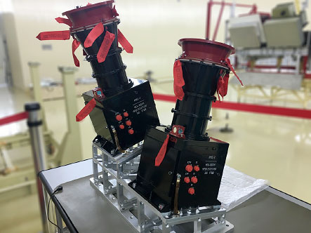
Satellite Multiband Imaging System
- Purpose: The system is designed for an optoelectronic survey of the earth and water surface in three spectral bands of visible and near-IR of electromagnetic waves spectrum.
- Year of release: 2012
- Guaranteed service life (years): 5 (LEO)
- Estimated production / delivery time (months): 24
- Flight qualification of the product: Yes
- Possibility to adapt the product to customer requirements: Yes
| Parameter | Value |
|---|---|
| Images' spatial resolution from a height of 830 km | 50 m |
| Number of spectral zones | 3 |
| Spectral bands | 0,520 – 0,590 mkm; 0,640 – 0,690 mkm; 0,785 – 0,900 mkm |
| Image dynamic range | 72 dB |
| Number of quantization digits | 10 |
| Data rate | 2 x 30,72 mbps |
| Weight | 2 x 7 kg |
| Power consumption | 2 x 15 W |
| Swath width | 2 х 500 km |
Satellite multiband imaging system consist of two identical multispectral camera devices made in the form of separate structural units.
Legal information
Please note that this site is for informational purposes only and under no circumstances is not a public offer determined by the provisions of the Part 2 Article 437 of the Civil code of the Russian Federation.
Information on this site may be changed or supplemented.